ON another beautifully sunny "work" day we ventured onto part of the Sustrans network that we all know least well; a stretch of route 68 leading north out of Buxton up towards Whaley Bridge and Chapel en le Frith.
The White Peak Ranger group has responsibility for the section of route 68, which leads out of Buxton along the main Manchester Road for a couple of kilometres, before it veers away from the A5004 on a much quieter road towards Combs Moss. At this point our group hands-over responsibility for the route to Joan Bennet who looks after the next section single handedly.
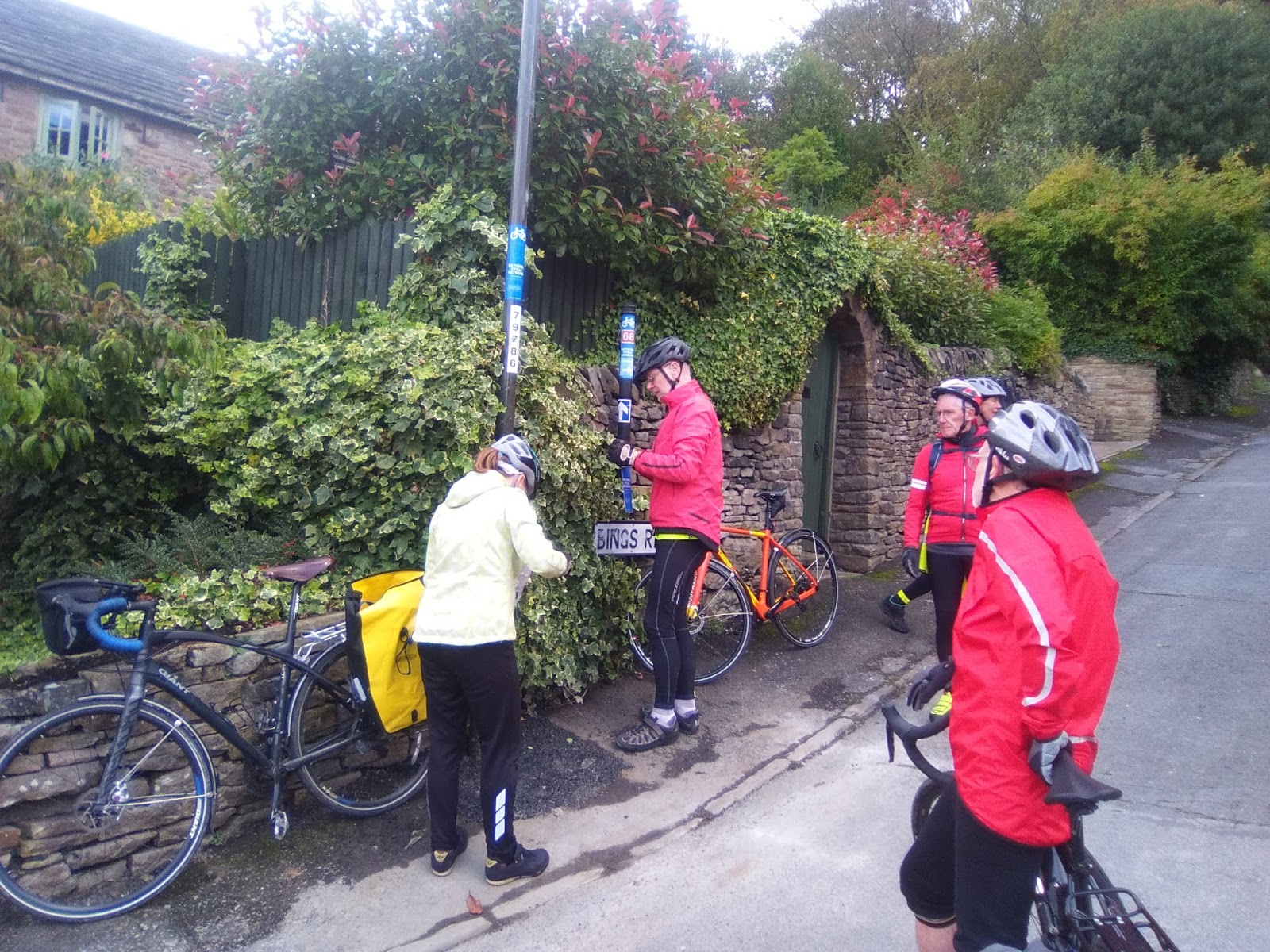
Myself, the Rookes, David Sharpe and Brian Raine met up with our newest recruit Naomi McFadyen at Buxton station full of enthusiasm for a ride into parts of the Sustrans network that we are all quite unfamiliar with. Or were we? It was most gratifying to see that the extra signs we put in place earlier in the year to link the station concourse on to route 68 were still all in place. We still think that they should help people get to/ from the station from route 68 quit ereadily and so we made no further adjustments. I wonder how many people have used them and thought how helpful they are?
With no more ado we set off up the hill out of Buxton keeping well into the kerb for safety from the traffic using the same road. This is not the best section of cycle route in the country. There is no cycle track marked on the road and although the flow of traffic was not really heavy it is a slow climb out of the town through a built up area. We did wonder whether there may be some back roads behind the station which might make the exit/ approach from the station more pleasant, but decided to leave that matter for another day.
We added a few more signs to lamposts as confirmation to users of the route that they were still travelling in the correct direction. Otherwise the signage put in place about 3 years ago all seemed to be fine and only needed replacing where the sun and rain had weathered the existing signs so badly they could hardly be seen.
The point at which our responsibilities are handed over to Joan is on a dangerous bend in the A5004, but it is well signed and I guess there is a verge that cyclists can pull onto if traffic is exceptionally heavy. Unfortunately Joan was unable to ride with us on this day but she had said she was happy for us to check the route up to Whaley Bridge, if we had time.
This little lane that we now found ourselves on was new territory for me, but it was still heading north in an upwardly direction. After a short while the tarmac comes to a very sudden end and, as on our September ride, we once again found ourselves on a very rough track that many Sustrans users would find difficult to cycle on. Maybe we can try to find somebody who can "sponsor" a few lorry loads of gravel that would improve the surface enormously? Having survived the worst of it the track it levelled off a bit before deteriorating alarmingly once again to bring us down the side of the hill behind the White Hall centre. There are no alternatives for this "rough" section but maybe we need to go back and put some "rough track" stickers at either end?
Whilst these poor surface sections take a while to navigate safely they are not especially long in length. Once past them the route returns to a tarmac surface along the delightful Old Road and Long Lane before a steep drop down into Whaley Bridge. Once again, only minimal work necessary to the existing signage.
It was only as we came into the town that Naomi let on that she had lived in Whaley Bridge for many years and knew it really well. Just below where she used to live we had a major discussion about the need for siting of additional signs where the route takes a sharp deviation away from the town. It was only when David (S) located a "stray" drainwater pipe and returned it to its correct position that it all became clear as to what was required!
With Naomi's inside knowledge we enjoyed a cup of tea in a lovely cafe (thank you David) before settling to our sandwiches overlooking the canal basin. Although the sun was shining it was very autumnal sitting by the water and we all foolishly said that what we needed to warm us up was a hill!. Well , we certainly had them on the return route back to Buxton via the lovely Fernilee reservoir. We had two really monster hills, both of which went on for what seemed like endless mile after mile. Brian of course coped with them very comfortably on his e-bike. The rest of us took them more slowly. Despite the hills this made a wonderful circuit and left us with just a downhill ride along the A5004 back to our starting point at the station.
Well done everyone, another really useful day of route checking in an area that is at the extremity of our region.

You mention steep hills on the way back to Buxton, climbing away from the Fernilee reservoir. One of these was probably Bunsall Hill, which used to be a section of the Cromford and High Peak Railway, now tarmacked over and a road. We are used to seeing the C&HPR as the High Peak Trail. The railway ultimately connected the Cromford Canal with the Peak Forest Canal basin at Whaley Bridge but this bit, north of Buxton, closed around 1900, while the rest carried on till 1968. The railway went alongside the Fernilee Reservoir and down (or up) the Shallcross incline, which I guess you must have also gone along. DCC made quite a good job of tidying up the incline a few years ago.
ReplyDelete